 Today started with this little earworm from The Eagles on the radio. That’s all about that, as I can’t stand The Eagles.
I found my legs a little more this morning, I’m glad to say. Yesterday I made the mistake of wearing a knee support to deal with a bit of pain I’d been having (mostly when going downhill), but all it did was rub on the back of my leg – today I didn’t wear it, and it was fine.
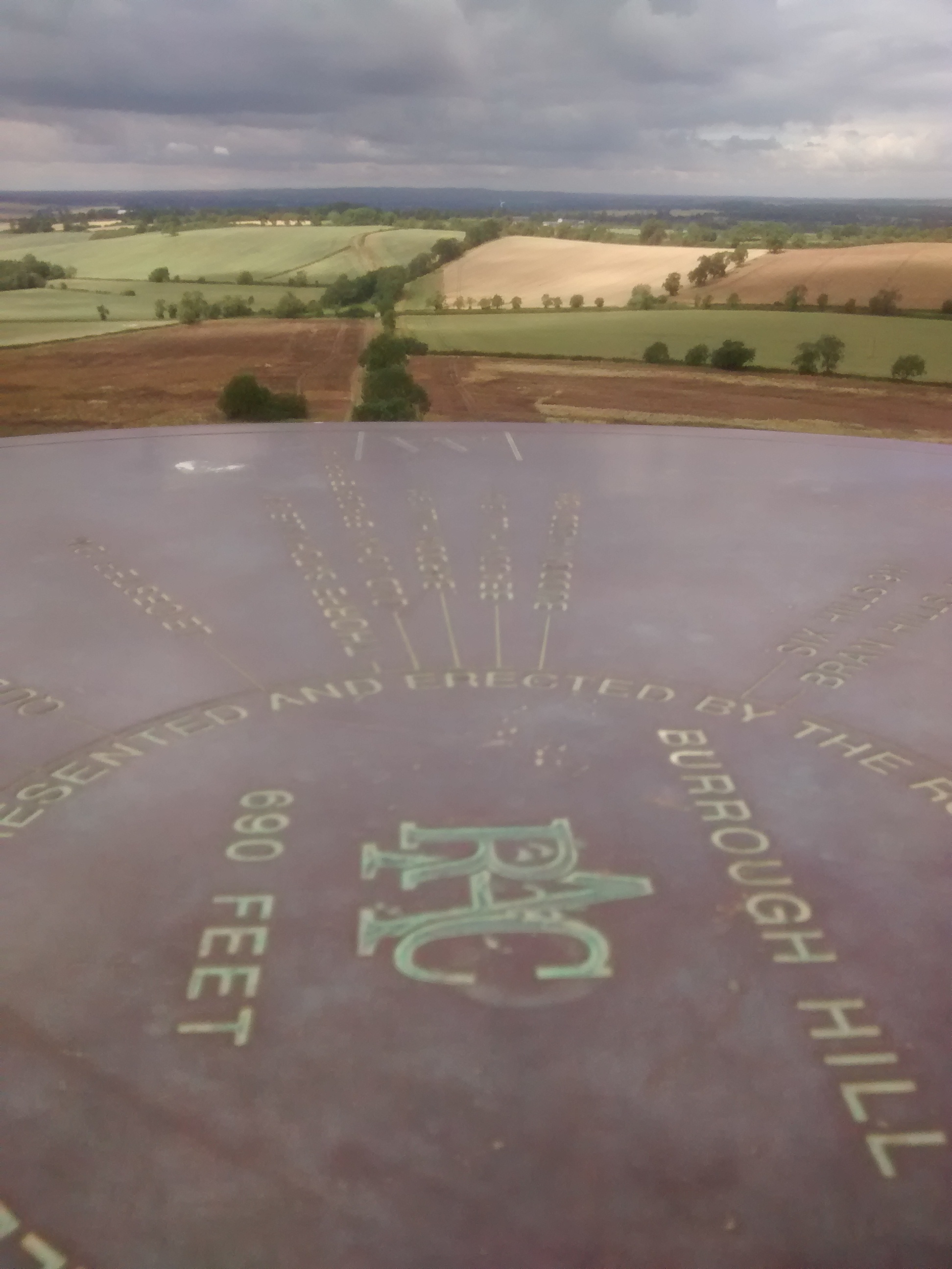
There was also not a huge amount of uppy downy bits, aside from the climb up the mound of the ancient fort that is Burrough Hill.
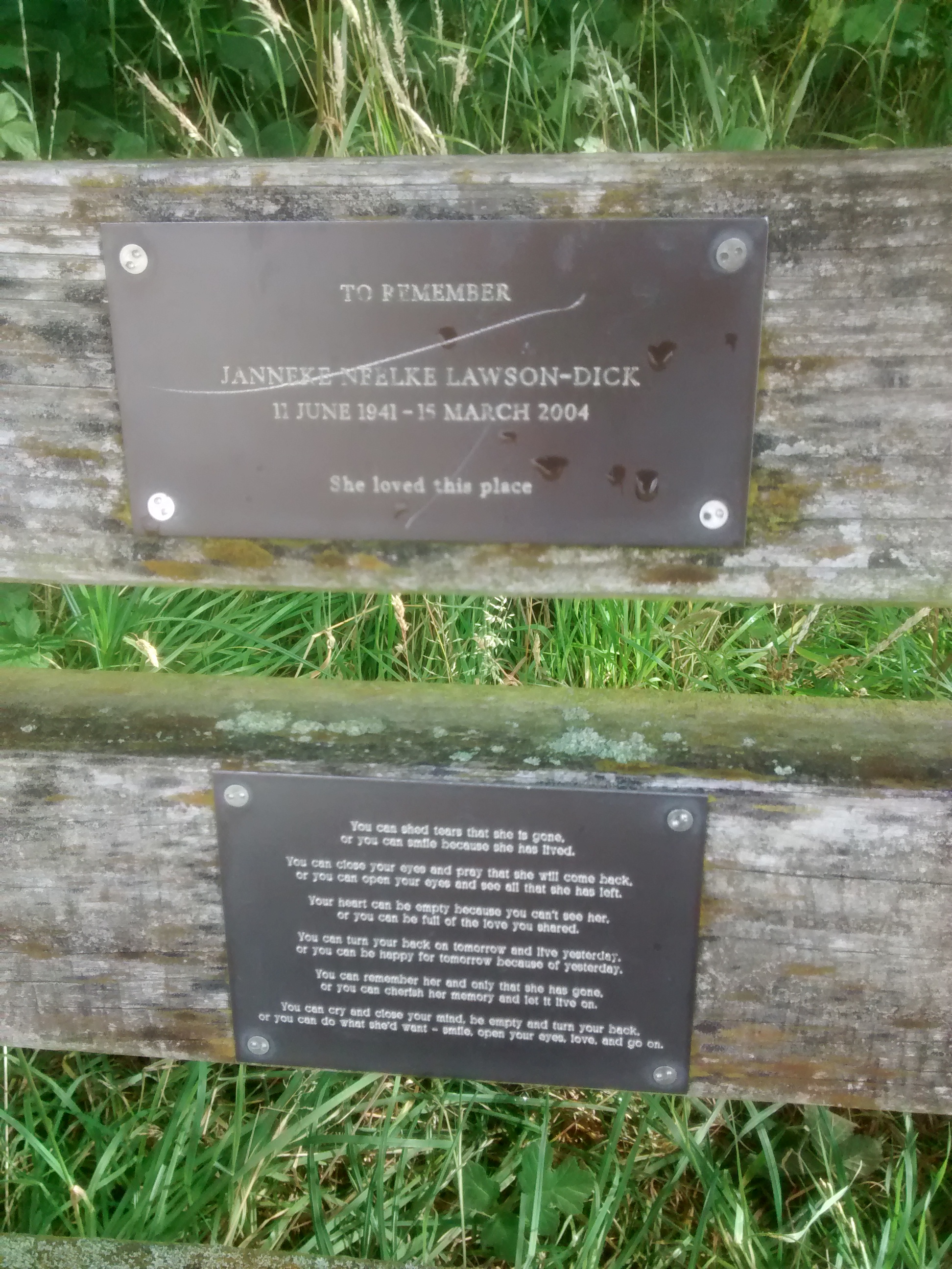
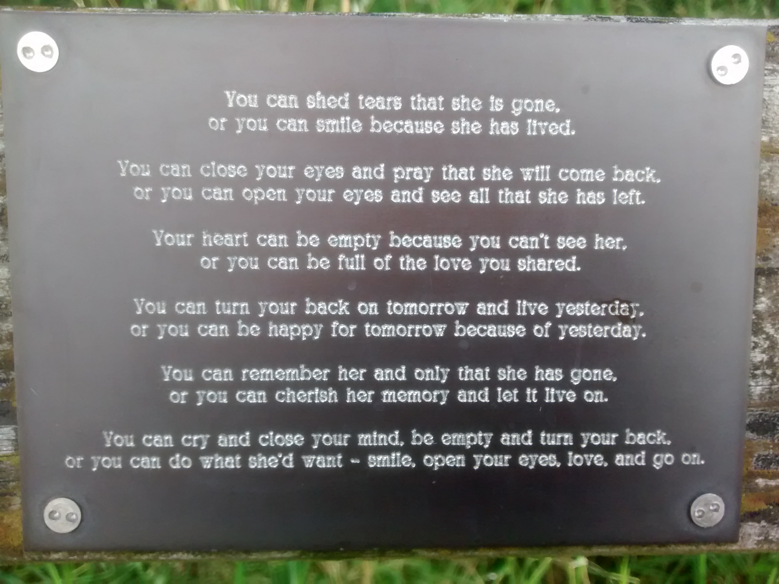 Just outside Owston, I came across one of the many benches along the Round erected in someone’s memory. But this had more than the usual dedication, it had the piece of prose as shown in the photo – a reminder that to respect someone’s memory, you need to be thankful of what they’ve given you, but that ultimately, life is for the living.
On to Somerby, which the Round pays very little attention to, crossing it’s main street with what some might think a casual disregard. Just outside Somerby, I came across people! Yes, actual people, a couple also walking along the Round (not quite as far as me though). I was able to assist with some navigational advice, and I met up with them again on Burrough Hill. It did make me realise though, that perhaps one of the things I was missing yesterday was people – I didn’t see another soul until I stumbled back into Belton In Rutland. I might not be a social animal, but I do appreciate human contact every now and then, even if it’s just a ‘Hi’, or even just a smile.
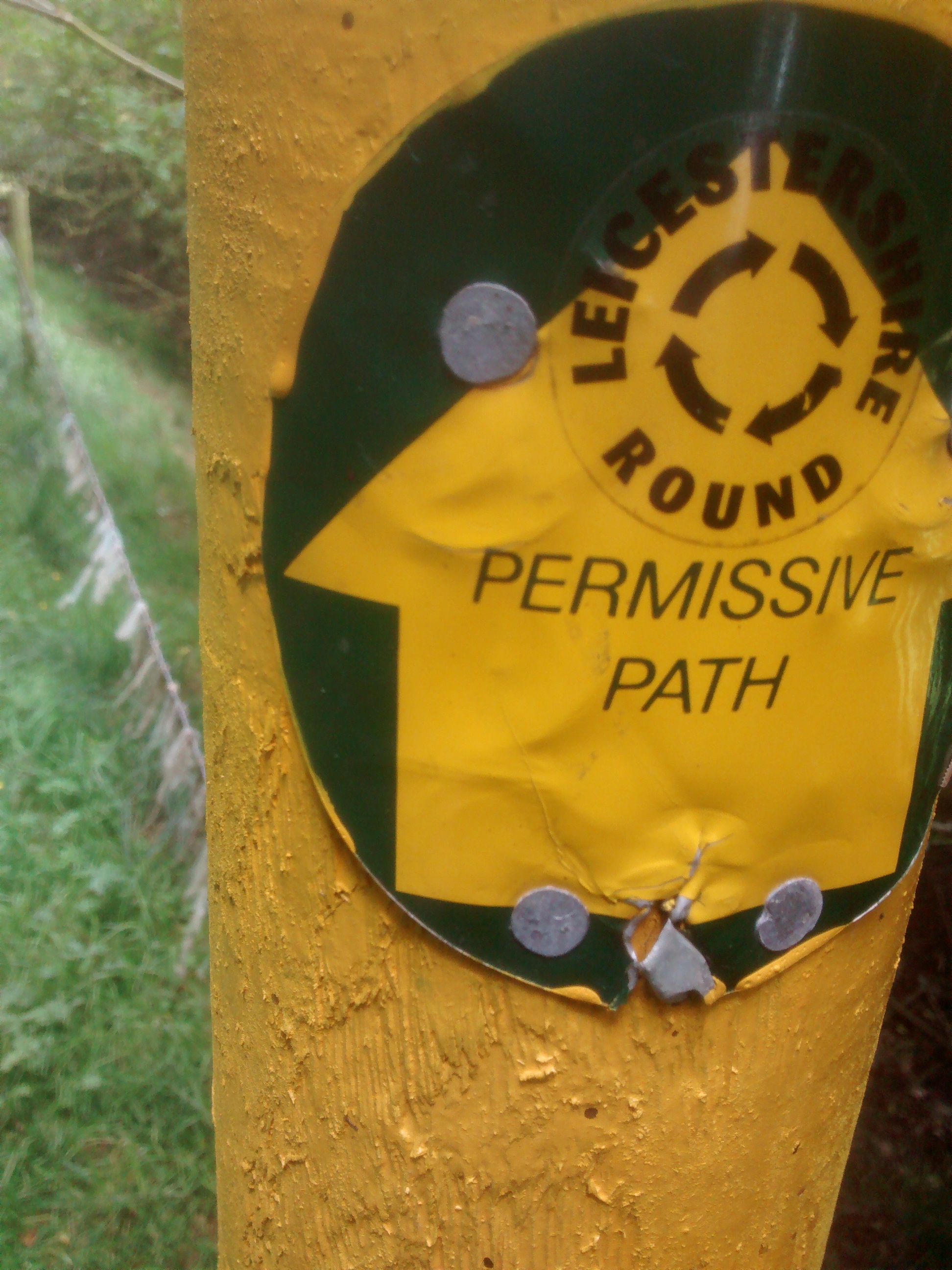 After a few fields outside Somerby, I was able to work out what was going on with the footpath up to Burrough Hill. There isn’t one. That’s what was going on with it. Well, that’s not quite correct, there is a permissive path, but that’s at the whim of the land owner, and while the Leicestershire Round is plotted on the map as going through Punch Bowl Covert (love that name) and Rise Hill Spinneys, there isn’t a legal right of way. It has to be said, though, that the permissive path is of a far better standard than many a legal right of way I’ve had to misfortune to deal with. Sticking to the permissive path however, brought me out at the bottom of Burrough Hill. Several wheezy and spiky moments later, I’d forced my way through the gorse to the top to be reacquainted with the couple I met earlier in the day.
There isn’t a great deal to say about the track and then road up to Thorpe Satchville, other than I walked along them to have lunch at Thorpe Satchville, before returning.
But on the return I journey I met more people back over Burrough Hill. Again, the young ladies and their children weren’t walking quite as far as I was (I think they said they’d walked from the carpark), but we had a brief chat about what I was doing, and they wished me luck.
Unfortunately, whether it was my fault or not I don’t know, MapMyWalk lost today’s data. So I don’t have accurate data on how far I walked (I’m pretty sure it was around 12.9 miles – a walk in the park / rest day), which is irritating. But I dare say I’ll get over it. And I’ll be more careful not to quit the application until I’m back at home and the data has been synchronised with the server from now on.
From now on (aside from the section from Mountsorrel to Newtown Linford), I’ve already walked the rest of the Round all the way back to Foxton at one time or another. And, today saw the last of the eastern-most part of my journey. So, westwards tomorrow, onto Hoby.
Follow me